August 15, 2018 feature
Remote sensing techniques could improve electrification planning in Zambia

Researchers at the Reiner Lemoine Institut in Berlin have effectively used remote sensing techniques to detect a sample of Zambian villages that are without electricity. Their study, recently published on Springer's Proceedings in Energy book series, highlights the potential of machine learning strategies to improve electrification planning in less developed parts of the world.
Despite the improvements that took place over the past few years, many regions in Sub-Saharan Africa still have limited access to energy sources, including electricity. According to the Institute of Economic Affairs' (IEA) World Energy Outlook 2017 report, two-thirds of the 17 million people living in Zambia lack electricity.
To address this problem, it is first necessary to attain accurate and detailed information about the current state of electrification in the country, identifying the location and distribution of households that have no access to electricity. This important data could then be used to assess the feasibility of different electrification options, such as stand-alone systems, mini-grids, or grid extensions.
"Creating a better understanding of regions with limited or no available electricity supply to develop respective energy supply options requires the geospatial data on where people live," Catherina Cader, one of the researchers who carried out the study, told TechXplore. "Very often, especially in less developed countries, such data or detailed spatially disaggregated information is not available, or only in summarized country statistic, without location-specific information."
![Overview of the classified wards [overlaid on Open Street Maps © OpenStreetMap contributors under Open Data Commons Open Database License (ODbL)] Credit: Cader et al. Remote sensing techniques could improve electrification planning in Zambia](https://scx1.b-cdn.net/csz/news/800a/2018/1-remotesensin.jpg)
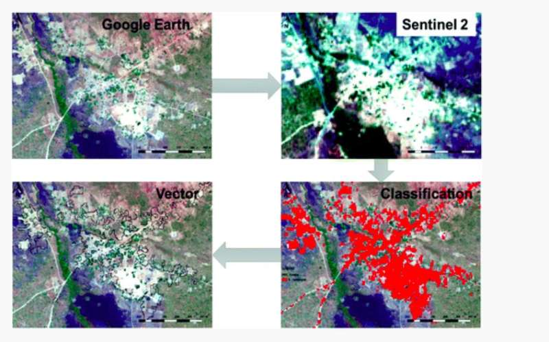
In a recently published study, Cader and her colleagues investigated the use of openly available satellite imagery and machine learning tools to fill this knowledge gap, ultimately improving energy access planning. The researchers used remote sensing techniques, which involve the application of machine learning algorithms trained to classify medium-resolution Sentinel 2 multispectral imagery.
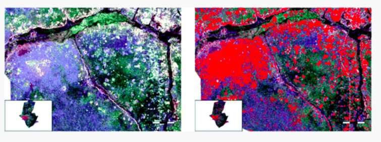
"We used satellite data to derive settlement structures and populated areas to delineate village boundaries," Cader explained. "To achieve that, land cover classification is carried using algorithms to automatically detect inhabited areas based on previously developed training sites."
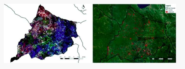
The algorithms used by the researchers were able to classify 14 wards without electricity, with a total area of approximately 10,000 km2. These results are very promising, highlighting the potential of remote sensing to improve the distribution of energy in Zambia, as well as in other countries in Sub Saharan Africa.

"Open satellite data sets and open source software allowed us to carry out successful classifications to identify the location of villages," Cader said. "This information can be used further for energy access planning."
In future, their findings could inform the work of official bodies operating in the region, such as the Rural Electrification Authority (REA), as well as that of private entrepreneurs who are planning to carry out electrification works. Information gathered using remote sensing techniques could also be used in combination with other open source data to provide better population estimates for the detected villages.

"Building on our previous research we are now working on combining remotely sensed data with location-specific survey data necessary for energy access planning, such as electric appliances, household expenditures, or productive use," Cader said. "This could help to identify correlations and allow for a spatial extrapolation of findings to sites which are outside the survey sample."
More information: Catherina Cader et al. Remote Sensing Techniques for Village Identification: Improved Electrification Planning for Zambia, Africa-EU Renewable Energy Research and Innovation Symposium 2018 (RERIS 2018) (2018). DOI: 10.1007/978-3-319-93438-9_7
© 2018 Tech Xplore


