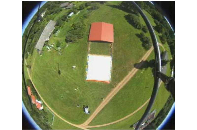
Open reflectance target. Credit: Ural Federal University
For the first time, an international team of scientists from Russia, Estonia and Finland has analyzed the operation of a target panel built in the southeast of Estonia to calibrate orbital satellites and to ensure maximally accurate remote sensing of the planet's surface for analyzing the conditions of soil, crops, harvests, pastures, forests, urban areas, transport, industrial infrastructure, natural disasters, emergencies and other purposes.
The scientists have published the research results in the International Journal of Applied Observation of the Earth and Geoinformation.
The panel was constructed on the territory of the Järvselja Nature Reserve between Tartu and the Estonian-Russian border, and is a perfectly smooth, horizontal, plain gray concrete platform 10 × 10 meters in size, protected from environmental exposure by a removable roof.
"There are several methods for calibrating the sensors of artificial Earth satellites. The first is laboratory tests. This is data on light of a particular wavelength scattering at a particular angle and in a certain medium, for example, volcanic sand, and detected in sterile conditions by comparing the reflection spectra with special designs of the diffuser. The second method of satellite sensor calibration is using airfields or deserts, since their composition is homogeneous, and the state is relatively stable. However, neither method can be compared in accuracy with the one we use," says co-author Maria Gritsevich.
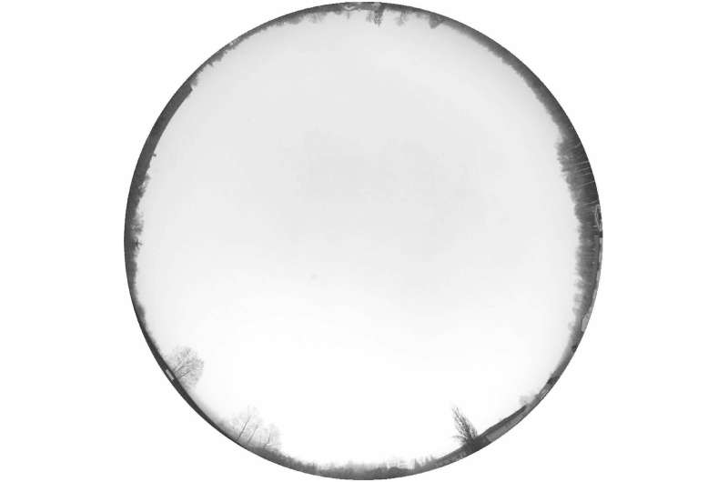
Cover of horizon in the center of the panel. Credit: Ural Federal University
For example, the airfield grass changes its color throughout the year, but the platform developed by the scientists is "of the same color in winter and summer." This feature provides high-quality measurements, which is fundamentally important—satellite sensing is very expensive and the cost of a mistake is high. When the satellite targets the platform on Earth, it receives data that serves as a standard in the tuning of the measurements that the satellite outputs in the course of surface monitoring. Without calibration via comparison with the standard, the data obtained during the sensing are irrelevant and cannot be interpreted or applied.
The calibration process is as follows: The panel reflects a stream of light coming from the sun or from a satellite, and polarizes it—that is, it converts natural, unordered light into an ordered bundle of oriented rays, which is received and processed by satellite sensors. Thus, the satellite measures the polarization in addition to the light intensity. Moreover, using the platform, it is possible to achieve a detailed picture of how a certain wave of a particular frequency and length behaves in a given light scattering geometry. It is worth noting that the panel in Järvselja gives a stable signal throughout the year, which ensures steady reproducibility of the processes and results of satellite measurements and points at the reliability of the system.
Additionally, the panel can be used for processing measurements beyond just visible light (waves ranging from 380 to 760 nanometers in length). The scientists have investigated how the panel interacts with waves in the range of up to 2,500 nanometers, that is, in the field of infrared and microwave radiation.
"Some satellites are designed so that they capture only waves of a certain length and at a certain angle with which these waves are reflected from the Earth's surface. The large wavelength range in which the panel that we studied and described operates allows us to tune a wide range of instruments, including artificial Earth satellites," says Maria Gritsevich.
Moreover, the use of the Estonian panel as a standard allows the improvement of new models of artificial satellites, choosing the optimal wavelength, observation geometry (angle of light reflection) and image resolution.
More information: Andres Kuusk et al. Reflectance reference target at Järvselja, Estonia for the calibration of optical remote sensing sensors and lessons learned, International Journal of Applied Earth Observation and Geoinformation (2018). DOI: 10.1016/j.jag.2018.06.013
Provided by Ural Federal University


