December 19, 2020 report
Satellite uses SAR imagery to capture world's sharpest images

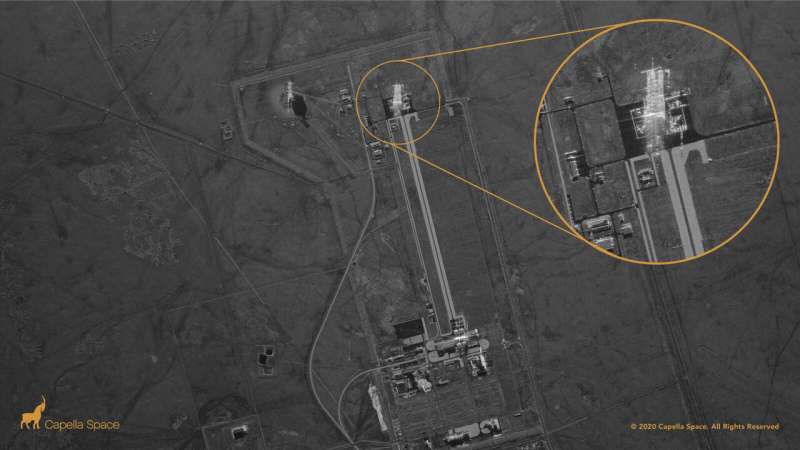
A satellite carrying a camera that is so powerful it can capture an image of virtually any object on Earth with crystal-clear resolution is now offering its services to the public.
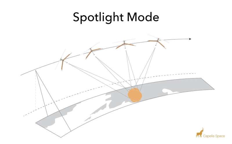
The Capella-2 satellite, developed by San Francisco-based Capella Space, uses synthetic aperture radar (SAR) technology to obtain super-sharp photos for use by military, environmental, energy and law enforcement sources. Even regular folks can sign up online to have a photo taken of any spot on the planet (provided they first obtain clearance from the U.S. International Traffic in Arms Regulations).
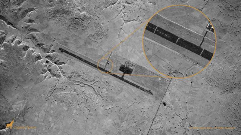
With a capacity to identify objects as small as 50 cm x 50 cm (roughly 20 inches x 20 inches), Capella's breakthrough technology makes it the highest-resolution satellite camera in the world. It exceeds the resolutions of its nearest competition—there are few competitors in the field of SAR photography—which can identify only those objects no smaller than about five meters, or just under 200 inches.
One way Capella differs from all competition using SAR and regular optical photographic processing is that images can be captured day or night, and regardless of weather conditions.
"It turns out that half of the world is in nighttime, and half of the world, on average, is cloudy," said CEO Payam Banazadeh, a former system engineer at the NASA Jet Propulsion Laboratory. "When you combine those two together, about 75 percent of Earth, at any given time, is going to be cloudy, nighttime, or it's going to be both."

Banazadeh said his goal for the past four years of research was to create "a new tool for humanitarian work and human progress." Capella 2, he said, "allows us to monitor our planet in all-weather and in all-light conditions and to do so reliably and transparently."
Interestingly, Banazadeh was motivated by tragedy. He said he was frustrated with agonizingly slow global efforts to track down the wreckage of Malaysian Air Flight 370 that killed all 239 aboard after it mysteriously disappeared in 2014. No cause was ever confirmed.
"Governments around the world sent ships and vessels to look for this plane, and the tragedy took forever to play out," Banazadeh said. "I remember watching TV and thinking, 'We've failed as Homo sapiens if a massive plane has gone missing with 280 fellow human beings on it and we have no idea where it went missing, what happened, and what's going on.'"
He said three is a need "to do better at tracking things" and to "be better at understanding the planet we live on."
One satellite is in orbit now, but the company plans to launch two more aboard SpaceX in the near future. Government contracts, including one with the U.S. Navy, will soon bring several more to the fleet.

Early reports this week erroneously indicated the Capella is so powerful it can see through buildings. Banazadeh quickly took to social media to put that rumor to rest.
"Vaccines don't contain microchips and SAR can't see through walls into your living room!!!" He said in a Twitter post Friday.
But it is powerful enough to monitor wildfires, oil dredging operations, regions devastated by climate change and illegal poaching.
"SAR allows us, our first responders, our policy makers, and the world to see," Banazadeh said. "That is critical."
More information: www.capellaspace.com/capella-u … mercial-sar-imagery/
© 2020 Science X Network


