This article has been reviewed according to Science X's editorial process and policies. Editors have highlighted the following attributes while ensuring the content's credibility:
fact-checked
trusted source
proofread
Q&A: What is the state of underwater geolocation technology?

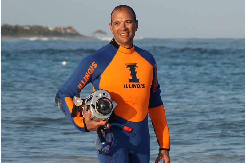
The loss of OceanGate's Titan submersible has triggered questions about how underwater craft navigate and how these vehicles can improve their geolocation abilities. Electrical and computer engineering professor Viktor Gruev spoke with News Bureau physical sciences editor Lois Yoksoulian about the current state of the science behind underwater geolocation, and some advances his team is working on now.
Early news of the missing Titan submersible had many asking if the craft was equipped with GPS and if that could have helped the search. However, GPS does not work underwater. Can you explain why?
GPS technology operates by receiving signals transmitted from multiple satellites and employing complex mathematical calculations to determine one's position. Its origins trace back to the 1970s, and it has become extensively utilized through smartphones and various applications like Google Maps and Apple Maps.
Nevertheless, the signals emitted by satellites cannot penetrate water. When radio waves from satellites encounter the water's surface, they merely bounce off and continue their journey through the air. Consequently, despite its widespread use as a commonplace technology, GPS does not function underwater. A state of "radio silence" prevails beneath the water's surface.
What kind of technology was used in the search for Titan?
The search missions were conducted in two distinct regions: near the ocean surface and near the seafloor. The objective was to locate a submersible that could be situated at any depth and anywhere in the ocean. The reason for dividing the search efforts into these two regions is primarily attributed to the limitations of current technology.
Deep-sea operations pose significant challenges, including immense pressure, which restricts the availability of suitable technologies for such missions. Although more options exist for search and rescue operations near the surface, covering large areas and searching for the target still demands substantial time. These technologies rely on sonars, which utilize sound as a "flashlight" to reveal objects in the water. However, sound behaves differently in water, often creating echoes and concealing the object's precise location as it bounces multiple times.
What kind of technology was aboard Titan?
A crucial attribute of the Titan was its initial ability to endure the immense pressure experienced at depths of 3,800 meters, which is approximately 380 times greater than at the surface. This was achieved through a pioneering combination of carbon fibers and a titanium hull. Unfortunately, there is limited information available beyond these details.
A concerning aspect within this industry is the need for established standards and certifications. Unlike the automotive and aviation sectors, which are subject to comprehensive regulations and well-defined testing metrics, the same level of oversight does not currently exist for these new submersibles, possibly due to their relatively small market share. However, it is imperative that this issue be addressed and rectified in the future.
Why don't we have better knowledge of seafloor geography?
Despite water covering over 70% of the Earth's surface, our understanding of this vast underwater world remains limited. Surprisingly, we possess more knowledge about exoplanets than we do about the depths of our oceans. While we have accomplished successful recovery missions in space, spanning thousands of miles, we still encounter challenges locating objects just 4 kilometers beneath the water's surface. It is evident that there is a pressing need for further advancement and widespread deployment of underwater technology.
How is your research at the University of Illinois helping advance underwater geolocation technology?
In my laboratory, we are pioneering the development of a fundamentally different technology that holds promise for underwater navigation and GPS applications. Our focus lies in creating innovative imaging devices and employing machine-learning algorithms that leverage the behavior of light underwater to ascertain the camera's location.
Essentially, our technology can be seen as a modern-day version of the sextant—an instrument that aided oceanic travel for centuries. By utilizing the polarization properties of light in underwater environments, we can determine the position of celestial bodies such as the sun or moon. With the aid of a clock, we have devised a unique method for location determination.
Our entire device is compact and can operate on battery power. The goal is to deploy small robotic platforms that can traverse oceanic waters, utilizing our navigation technology and identifying and noting the location of intriguing objects. This technology can operate up to a depth of 300 meters, making it particularly valuable for near-surface search and rescue missions.


