This article has been reviewed according to Science X's editorial process and policies. Editors have highlighted the following attributes while ensuring the content's credibility:
fact-checked
trusted source
proofread
Satnav test on remote island lab

ESA's navigation testbed vehicle participated in a campaign organized by Norwegian governmental authorities to assess the impact of jamming and spoofing on satnav systems and test innovative technologies for detection and mitigation.
Satellite navigation has become indispensable in our daily lives and is used in a myriad of applications, from guiding aircraft and driverless cars to monitoring water supplies and responding to emergencies. But satnav systems are potentially vulnerable to jamming and spoofing as their signal power on the ground is weak and most of their specifications are publicly available.
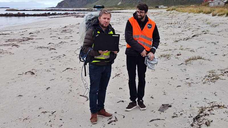
From 18 to 22 September, a team from ESA joined one of the world's largest jamming testing campaigns, Norway's Jammertest, together with dozens of participants from governmental agencies, industry and academia. An ESA telecommunications and navigation testbed vehicle usually based at ESTEC, in Noordwijk, the Netherlands, was driven to Norway for its first mission beyond Dutch borders.
The jamming testing campaign was organized by the Norwegian Communications Authority, the Norwegian Defense Research Establishment, the Norwegian Public Roads Administration and Norwegian Metrology Service and backed by the Norwegian Space Agency. The island of Andøya, a remote area in the north of Norway, was turned into a temporary outdoor laboratory where the organizers interfered with the Global Navigation Satellite System (GNSS) signal in a controlled environment.
ESA's testbed vehicle had been upgraded for this adventure: it was equipped with a variety of satnav receivers, antennas that ranged from the most sophisticated to mass market grade, interference monitoring equipment, antijamming antennas and other interference mitigation systems, and an inertial navigation system that served as the "source of truth," an independent relative positioning reference to compare readings from the receivers to the actual position of the vehicle. In addition to this, the van also carried an electronic support system and special batteries to power its instruments, as well as plenty of radiofrequency equipment and battery back-ups.
The equipment allowed ESTEC navigation engineers to test the performance of satnav systems and their resilience against jamming, but also spoofing—the sending of fake signals to mislead users about their location—as well as "meaconing," where signals are intercepted and rebroadcast in a misleading way. The team evaluated the capabilities of monitoring and mitigation systems too.
The testing site was already a challenging location for satnav systems: the high latitude means that fewer satellites are visible in the local sky compared to further south, and potential ionospheric activity linked to the northern latitudes can also interfere with signals.
Experimenting with European innovation
Among the equipment that was tested were devices developed in the framework of ESA's Navigation Innovation and Support Program (NAVISP), that focuses on devising novel positioning, navigation and timing technologies and services to boost Member State industrial competitiveness and innovation.
The team deployed a portable compact Radio Frequency Interference (RFI) detection system developed by SINTEF as part of the project ARFIDAAS: Advanced RFI Detection, Alerting and Analysis System. This device can record, analyze and classify interfering signals as soon as they are detected. ARFIDAAS was used to scan the electromagnetic environment before the start of each testing session to detect signal interferences unrelated to the campaign and derive an interference-free baseline.
The ESA team also tested a NAVISP-funded demonstrator receiver developed by FocalPoint. This device uses their patented technology Supercorrelation, which improves GNSS accuracy, sensitivity and integrity, increasing resilience to jamming attacks as well as allowing sky scanning and detecting spoofed signals.
NAVISP Industry Days, taking place on 7 and 8 November at ESTEC, will feature two presentations about Jammertest where participants will be able to learn more about the event and the team's experience in Andøya, including how they overcame challenges such as winds of up to 100 km/h and a flock of wild sheep interrupting a convoy mid-test.
Galileo holds strong
The Galileo system undergoes extensive testing in controlled indoor laboratory environments with the use of simulation equipment. Outdoor testing campaigns like Jammertest provide a unique opportunity for ESA, as the Galileo System Design Authority, to complement lab tests in real outdoor environments and feed the continuous improvement cycle that keeps the system protected against vulnerabilities.
"With this test we are closing the loop: we have been able to test the performance of different GNSS receivers and we can now provide feedback to ESA's Galileo system design team" says Radio Navigation Engineer Xurxo Otero Villamide.
Five days of testing produced terabytes of data that were recorded and stored. Engineers will now be able to replay the results and study them at ESTEC. Ground and User Segment Engineer Luciano Musumeci adds, "The primary campaign objective was to collect an extensive database for future exploitation, to support internal R&D activities for example. This has been successfully accomplished: we can use these data for years to come."


